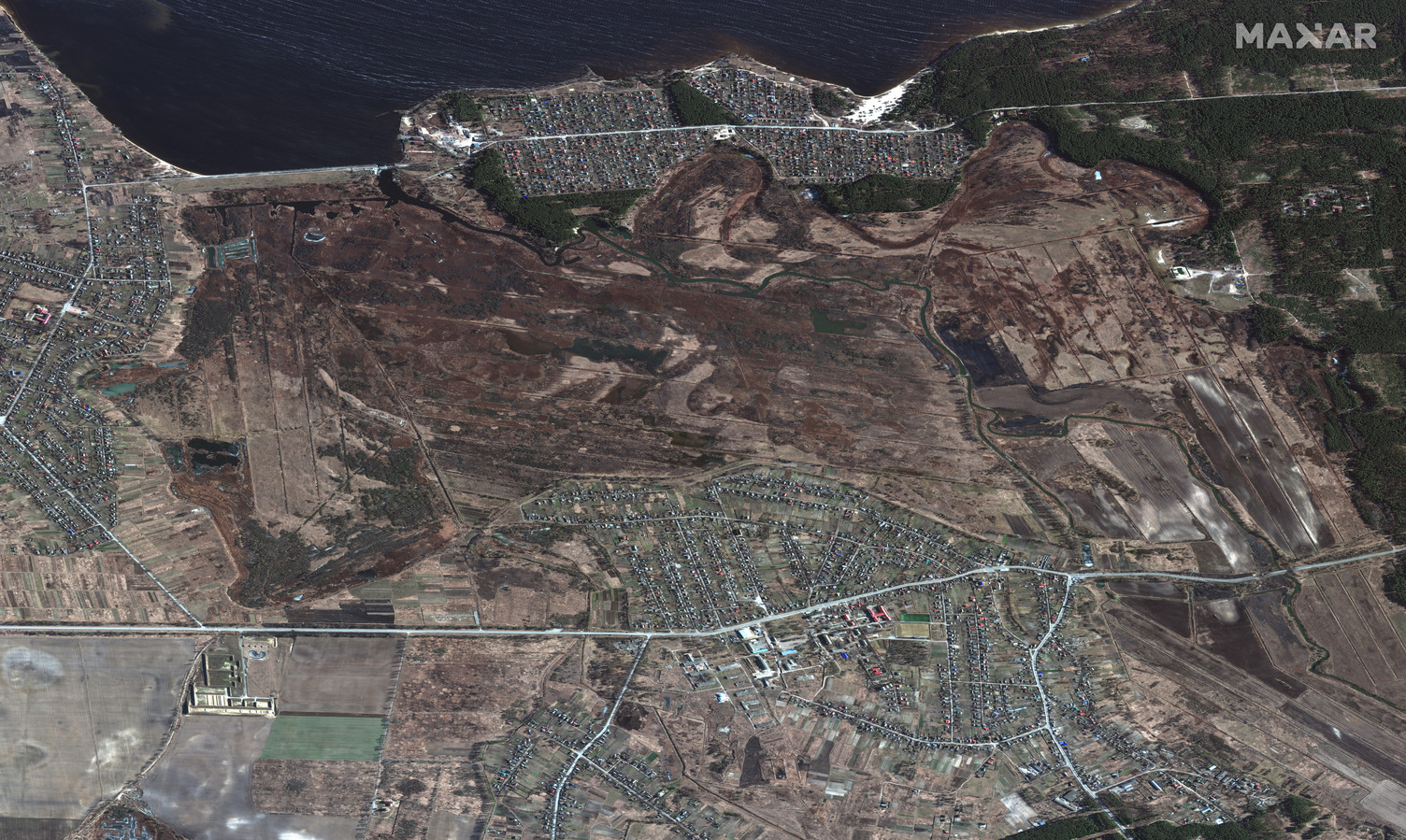
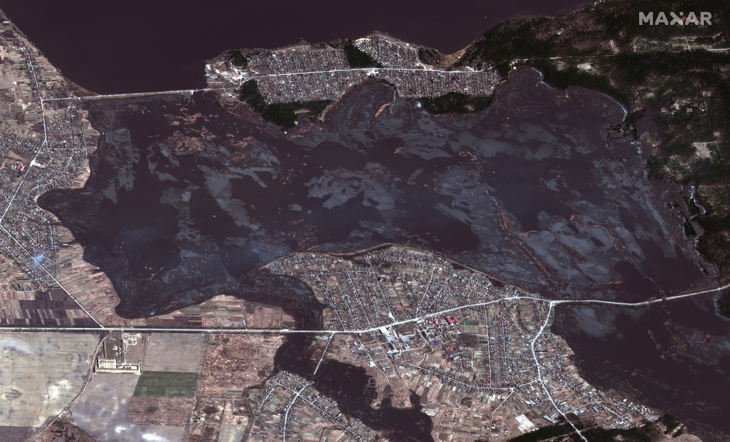
European Space Imaging and Maxar collected new high-resolution satellite images yesterday (March 22nd) of Mariupol that vividly shows the widespread destruction caused by Russian artillery shelling and airstrikes on residential housing areas, civilian infrastructure and industrial factories. North of Kyiv, floodwaters from the Kyiv Reservoir continue to spread along the Irpin River floodplain. Please see details below.
Mariupol Area
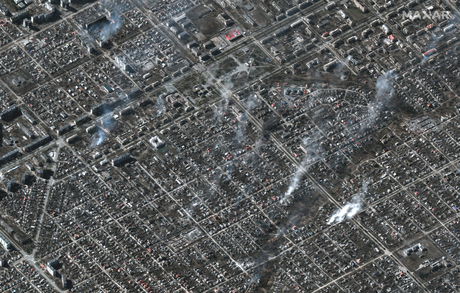
- Image 01: Overview of fires burning in residential area, Livoberezhnyi District (Location 47.107, 37.653)
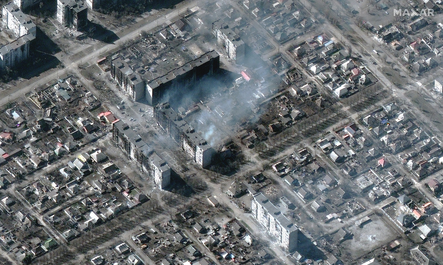
- Image 02: Burning high-rise apartment buildings (Location: 47.102, 37.654)
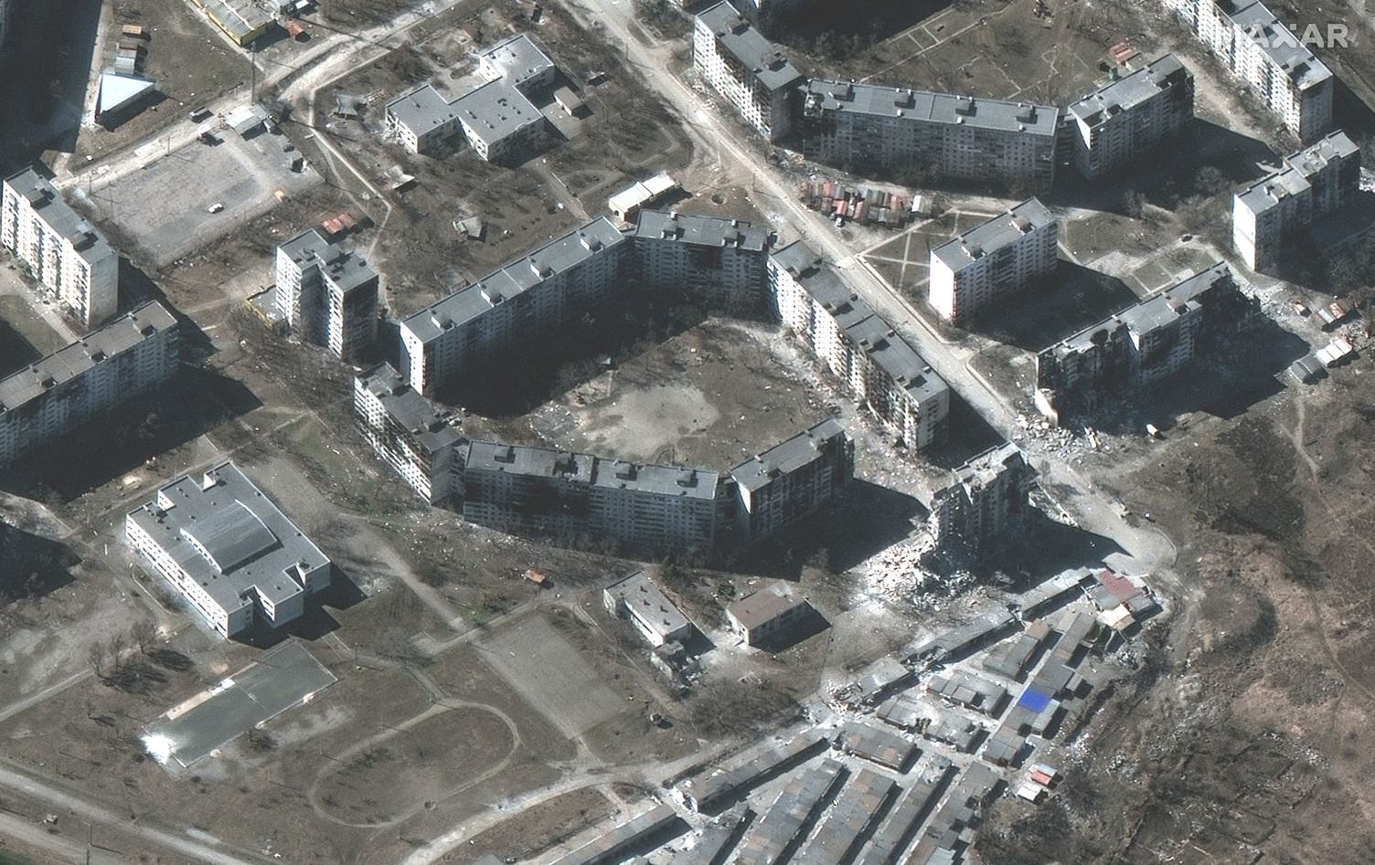
- Image 03: Heavily damaged apartment buildings (Location: 47.125, 37.684)
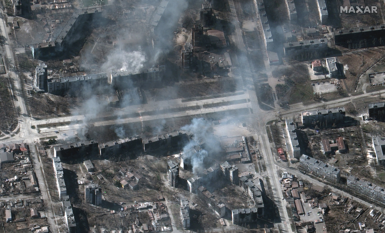
- Image 04: Buildings on fire (Location: 47.108, 37.557)
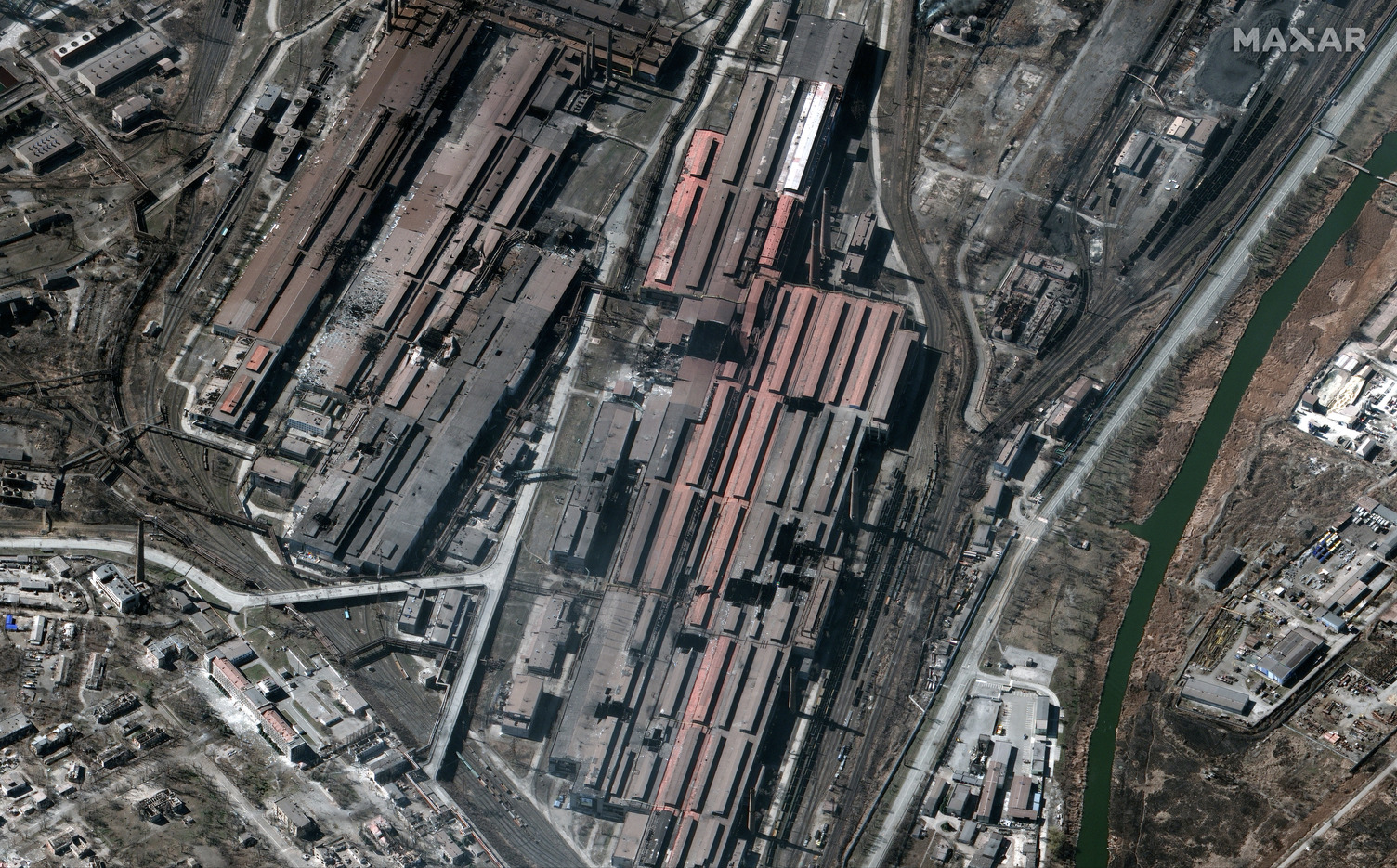
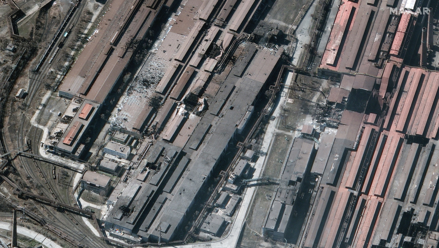
- Images 05-06: Damaged Azovstal Metallurgical Factory buildings (Location: 47.105, 37.684)
01_overview of burning buildings_livoberezhnyi district_mariupol ukraine_22march2022_wv3
02_burning and destroyed apartment buildings_mariupol ukraine_22march2022_wv3
03_destroyed apartment buildings_mariupol ukraine_22march2022_wv3
04_buildings on fire_mariupol_ukraine_22march2022_wv3
05_overview of damaged azovstal metallurgical factory buildings_mariupol ukraine_22march2022_wv3
06_closer view of damaged azovstal metallurgical factory buildings_mariupol ukraine_22march2022_wv3
North Kyiv Area
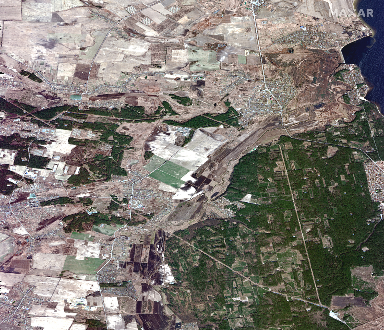
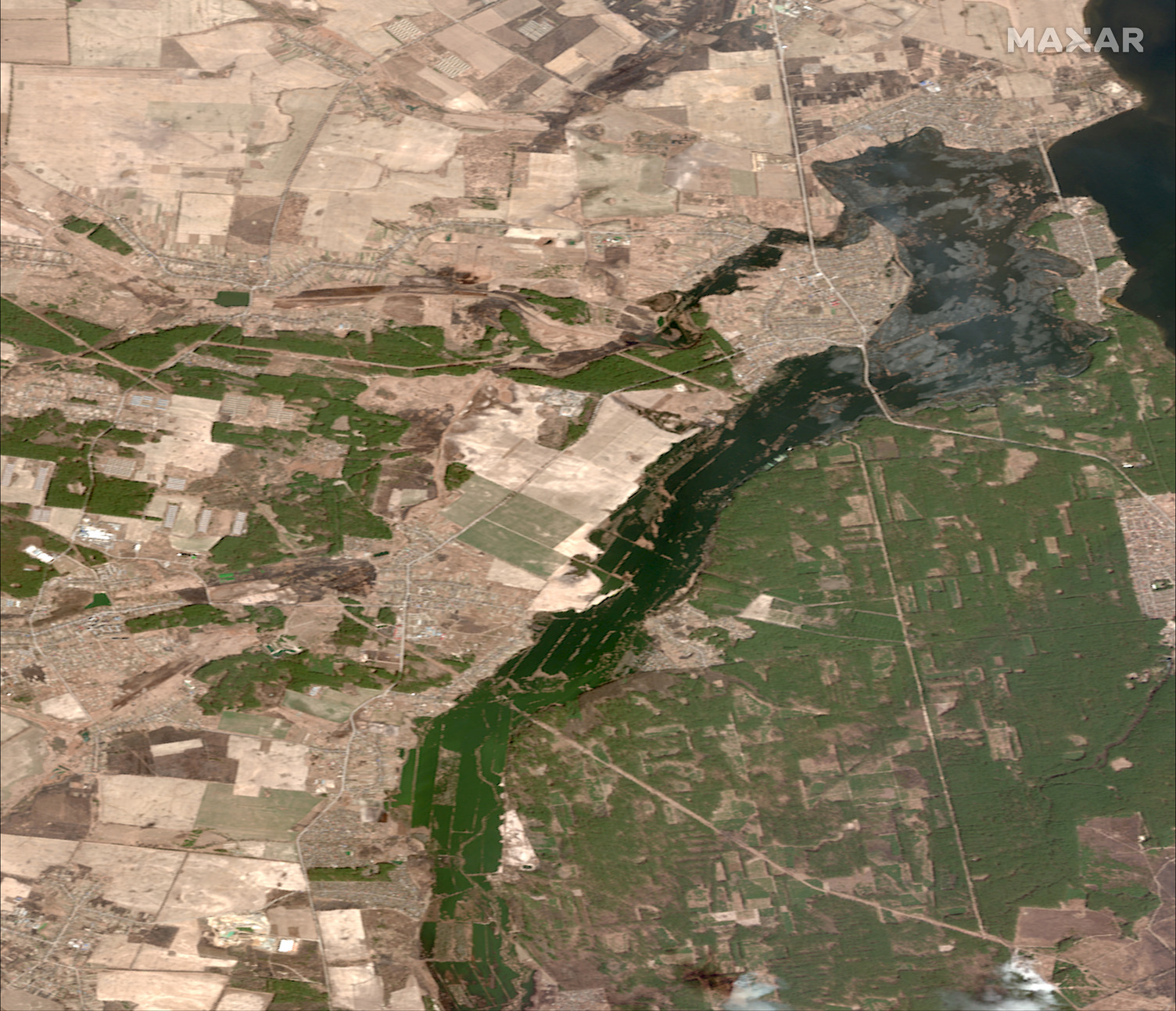
- Images 07-08: Overview of fields and Irpin River basin, before floods (28February) and today (22 March) (Location: 50.683, 30.295)
- Images 09-10: Closer view of flooded fields near Kozarovychi (Location: 50.744, 30.368)
07_overview of fields before floods_kozarovychi and kyiv reservoir_ukraine_28feb2022_wv3
08_overview of flooded fields_kozarovychi and kyiv reservoir_ukraine_22march2022_ge1
09_fields before floods_kozarovychi and kyiv reservoir_ukraine_28feb2022_wv3
10_ flooded fields_kozarovychi and kyiv reservoir_ukraine_22march2022_ge1
>