FARO® Introduces the ScanPlan™ Handheld Floor Mapper


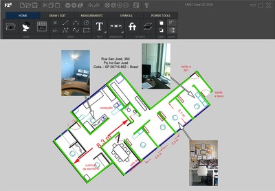
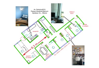
Add photographs and annotations directly to the floor plan to
document all the details of the scene.

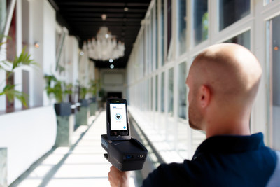
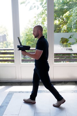
Walk through the building at normal speed and record an accurate 2D plan of the floors.

Capture floor plans in real time with the FARO ScanPlan.

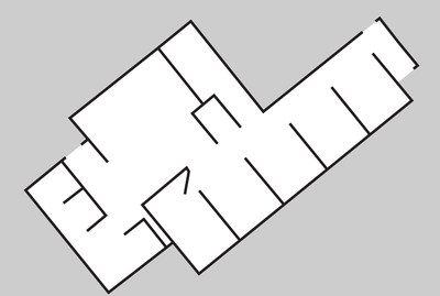
Process floor plans into 2D diagrams easily.

Save your plans to compatible formats for easy viewing access.

FARO logo. (PRNewsFoto/FARO Technologies, Inc.)

Cision View original content with multimedia: http://www.prnewswire.com/news-releases/faro-introduces-the-scanplan-handheld-floor-mapper-300706362.html

SOURCE FARO Technologies, Inc.


« Previous Page 1 | 2             
Featured Video
Latest Blog Posts
Jobs
Geoprocessing Product Engineer II for ESRI at Redlands, California
Sr. GIS Apps Product Engineer for ESRI at Portland, ME, Maine
Business Development Manager for Berntsen International, Inc. at Madison, Wisconsin
Sr. GIS Apps Product Engineer for ESRI at Portland, Oregon
Mechanical Test Engineer, Platforms Infrastructure for Google at Mountain View, California
Mechanical Engineer 3 for Lam Research at Fremont, California
Upcoming Events
GeoBuiz Summit 2025 at Hyatt Regency Aurora-Denver Conference Center. Denver CO - Jan 13 - 15, 2025
Coastal GeoTools 2025 Conference at 301 North Water Street - Jan 27 - 30, 2025
GEO Week 2025 at Colorado Convention Center Denver CO - Feb 10 - 12, 2025


© 2025 Internet Business Systems, Inc.
670 Aberdeen Way, Milpitas, CA 95035
+1 (408) 882-6554 — Contact Us, or visit our other sites:
AECCafe - Architectural Design and Engineering EDACafe - Electronic Design Automation TechJobsCafe - Technical Jobs and Resumes  MCADCafe - Mechanical Design and Engineering ShareCG - Share Computer Graphic (CG) Animation, 3D Art and 3D Models
  Privacy PolicyAdvertise