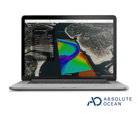
AUSTIN, Texas — (BUSINESS WIRE) — November 14, 2024 — Terradepth, a pioneer in ocean data technology, has officially launched a cloud-native geospatial platform for their offshore energy clients. Purpose-built to host complex maritime data, Absolute Ocean provides web-browser based access to ocean maps. Subsea data collected for stakeholders can be shared, visualized and collaborated on in near real-time, empowering smarter decisions and ensuring sustainable growth in challenging marine environments.
This press release features multimedia. View the full release here: https://www.businesswire.com/news/home/20241114672078/en/

Absolute Ocean's intuitive user interface (Photo: Business Wire)
“Critical ocean data has historically taken days to months to get to decision makers. Now, using the Absolute Ocean platform our users are able to share and access visualized data within 24 hours,” said Joe Wolfel, CEO of Terradepth.
As the offshore energy sector continues to navigate the greater energy transition, there is more pressure to optimize resources, minimize costs, while keeping data secure. The software operates in the cloud and can ingest diverse types of data, including bathymetric surveys, sonar scans, and video footage. By centralizing and simplifying subsea data access for teams, the secure platform offers visibility into the critical information they need to drive success.
“Current systems can take weeks to realize actionable data. Our offshore partners in petroleum and wind are enabled to access their data in near real-time from any location on our new platform. This leads to safer, more cost-effective, and more environmentally conscious operations,” continued Wolfel.
Key Benefits of the Absolute Ocean Platform Include:
- Enhanced Decision-Making: Absolute Ocean centralizes seabed mapping, asset tracking, and environmental data in one secure platform, enabling leaders to make informed decisions swiftly and with precision.
- Cross-Team Collaboration: Absolute Ocean’s cloud architecture promotes seamless collaboration between offshore and onshore teams. Data processing personnel can work anywhere in the world and concurrently to data collection to accelerate workflows. With a shared, up-to-date data set, stakeholders maintain alignment, greatly reducing timelines and improving the quality of decision-making across teams.
- Risk and Environmental Management: The platform can visualize terrain data collected over time allowing management to anticipate and respond to environmental conditions, track changes, detect tampering and safeguard both assets and the marine ecosystem.
As the offshore energy industry evolves, Terradepth’s Absolute Ocean platform is empowering executives to stay agile.
To learn more about Terradepth’s Absolute Ocean platform and how it is shaping the future of offshore energy, visit www.terradepth.com/absolute-ocean.
About Terradepth, Inc.
Terradepth, Inc., delivers ocean data better than humanly possible through their innovative technologies. They push the boundaries of ocean exploration with complete ODaaS (Ocean Data as a Service) solutions of autonomous underwater vehicles, streamlined survey services, and cloud-based geospatial data management. Operating globally from Austin, TX, and Panama City Beach, FL, Terradepth is transforming underwater exploration for faster, smarter maritime decisions.
View source version on businesswire.com: https://www.businesswire.com/news/home/20241114672078/en/
Contact:
Terradepth
Vanessa Gilbert
Director of Marketing
Email:
media@terradepth.com


