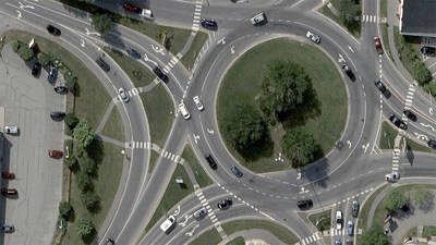
BOULDER, Colo., Sept. 22, 2021 — (PRNewswire) — Vexcel Data Program announced today it will enhance its entire Wide Area orthomosaic aerial imagery program to a 15-centimeter (6-inch) ground sample resolution starting in 2022. This program covers the contiguous United States and Western Europe, adding to and refreshing the company's massive aerial imagery and geospatial data library.

Vexcel currently collects the largest aerial program on the planet annually, and the new capture program will provide customers—from governments and utilities to telecom and insurance-—aerial imagery at a resolution, clarity, and accuracy that's never been delivered on a global scale. The new 15cm data is a true native resolution and not up-sampled from lower quality pixels. It will provide a 400% improvement over other aerial and satellite providers.
"We are thrilled to continue to invest in technology that allows us to offer this level of detail to our customers across the U.S. and Europe," shared Erik Jorgensen, CEO of Vexcel Group. "We're heavily focused on expanding our coverage with more detailed imagery and geospatial data, giving us the opportunity to meet the growing needs of our customers across the globe."
The new 15cm Wide Area program has already begun in some regions and will include 100% of the capture area in 2022. The new program will refresh and complement the company's robust library of geospatial imagery content, including a Wide Area program collected at 20cm and an Urban Area program collected with ortho and obliques at 7.5cm.
The aerial content will be collected using a fleet of aircraft carrying the new UltraCam Condor 4.1 sensors, designed and manufactured by Vexcel Imaging. The four-band sensor features a CMOS-based architecture that collects 1 frame every 0.7 seconds with a cross-track width of 48,462 pixels which is equal to 7.2 km at a 15cm GSD.
Some of the geospatial data produced from this new Wide Area capture include orthorectified mosaic 4-band and color-infrared (CIR) imagery and 3D elevation digital surface models (DSM) and digital terrain models (DTM).
Data Coverage in 20+ Countries at Unprecedented Scale
The Wide Area program covers 8.1 million km² in the U.S. and 2.3 million km² in Europe for a total area of more than 10.4 million km². The Wide Area program covers the contiguous United States and more than 20 countries in Western Europe, including Andorra, Austria, Belgium, Denmark, Germany, France, Italy, Ireland, Liechtenstein, Luxembourg, Portugal, Netherlands, Monaco, Ireland, San Marino, Spain, Switzerland, United Kingdom, and Vatican City. More countries will be added in 2022 too.
In addition to its Wide Area program, Vexcel also collects an Urban Area program capturing ultra-high, 7.5cm-resolution oblique and ortho imagery of major metro areas in Australia, Canada, New Zealand, United Kingdom, United States, and Europe. This makes Vexcel Data Program the only aerial program with both ultra-high resolution urban area and high-resolution wide area data captures in the United States and Europe. Multiple data products are available, including True Ortho, Ortho, Oblique, Vexcel Elevate (DSM/DTM), and Multispectral.
More Info
For more info and example imagery on the new Wide Area program, go to
vexceldata.com/wide-area
About Vexcel Data Program
For 30 years, Vexcel has been the industry leader in the photogrammetric and remote sensing space, providing a comprehensive library of cloud-based geospatial data. Vexcel's unique technology stack results in unrivaled image quality, helping customers streamline remote assessment, innovate common workflows, and enhance decision-making with confidence. Vexcel captures urban and rural areas across 20+ countries around the globe. More at:
vexceldata.com
Photo - https://mma.prnewswire.com/media/1632350/Vexcel_Data_Program_15_centimeter_Resolution.jpg
| Contact: |
| Company Name: Vexcel Data Program
Kris Wagner Email Contact Web: www.vexceldata.com |


