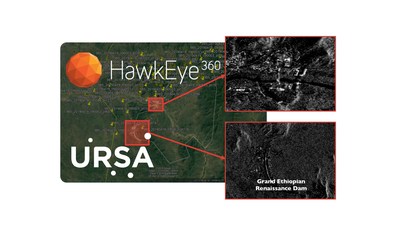
The partnership brings together space-based radar and radio frequency data analytics to advance global monitoring capabilities
ITHACA, N.Y., June 4, 2019 — (PRNewswire) — Ursa, a provider of geospatial intelligence solutions, announced a strategic partnership with HawkEye 360, the first commercial company to use formation flying satellites to create a new class of radio frequency (RF) data analytics. The companies will work together to develop new geospatial information solutions that combine synthetic aperture radar (SAR) data with radio frequency (RF) identification and geolocation to monitor activity across air, land and sea.
"Partnering with HawkEye 360 is a natural complement to Ursa's technology and aligns with our mission to help customers make more informed decisions based on geospatial data," said Ursa co-founder and CEO, Adam Maher. "We look forward to working in tandem with HawkEye 360 to develop more advanced solutions and introduce to the market new data sets that will provide deeper, more contextual insights into global activities."
Through this partnership, Ursa and HawkEye 360 will merge Ursa's SAR Virtual Constellation Marketplace (VCM) and leading SAR analytic capabilities along with HawkEye 360's RF data and analytics derived from the company's cluster of small satellites which provide a new global RF sensing capability. The real-time integration of these technologies introduces brand new products and services for surveillance on the land and oceans.
"We're excited to work with Ursa to demonstrate our capabilities, in maritime and land-based monitoring," said HawkEye 360 founder and CTO, Chris DeMay. "This partnership is a prime example of how HawkEye 360's powerful analytics provide people, governments and businesses with a greater understanding of global activity."
The initial market focus for the two companies will be maritime monitoring, where SAR and RF analytics will combine to provide valuable information in support of real-world applications such as ship traffic monitoring and examining illegal activity that occurs on the ocean. Joint efforts will then expand to land applications where HawkEye 360's RF sensing and analytics identifies activities of interest which can then cue URSA's SAR Virtual Constellation to monitor and provide actionable geospatial intelligence.
About Ursa
Ursa's vision is to create satellite-based data layers that anyone can explore to discover the truth of their world. Founded in 2014, Ursa pioneered transparency in the oil and gas supply chain by using satellite-based radar and is expanding applications of the technology into new supply chains and markets. Ursa's geospatial intelligence portfolio sets new standards for accuracy and reliability and empowers customers with critical insights. For more information, visit www.ursaspace.com.
About HawkEye 360
HawkEye 360 is a Radio Frequency (RF) data analytics company. We operate a first-of-its-kind commercial satellite constellation to identify, process and geolocate a broad set of RF signals. We extract value from this unique data through proprietary algorithms, fusing it with other sources to create powerful analytical products that solve hard challenges for our global customers. Our products include maritime domain awareness and spectrum mapping and monitoring; our customers include a wide range of commercial, government and international entities.

![]() View original content to download multimedia:
http://www.prnewswire.com/news-releases/ursa-and-hawkeye-360-join-forces-to-develop-geospatial-information-solutions-300861633.html
View original content to download multimedia:
http://www.prnewswire.com/news-releases/ursa-and-hawkeye-360-join-forces-to-develop-geospatial-information-solutions-300861633.html
SOURCE Ursa
| Contact: |
| Company Name: Ursa, HawkEye 360
Barokas Communications for Ursa Email Contact Web: https://www.ursaspace.com |


