


3D TARGET solutions are designed to be deployed in only five minutes, even by non-expert users, and can be configured to survey any landscape
SAN JOSÉ, Calif. — (BUSINESS WIRE) — May 9, 2018 — Whether an organization is surveying a highway tunnel while on a vehicle, riverbed by boat, warehouse on foot or farmland by air, 3D mapping advancements with LiDAR technology have made these once time-intensive survey projects faster and more efficient than previously possible.
This press release features multimedia. View the full release here: https://www.businesswire.com/news/home/20180509005027/en/
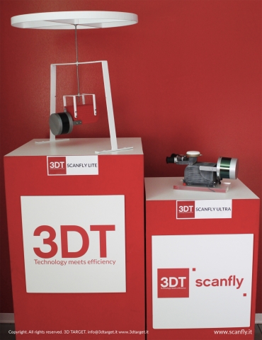
3D TARGET Scanfly Product Family (Photo: Business Wire)
The relationship between 3D TARGET and Velodyne LiDAR has been at the forefront of surveying innovation, resulting in the most compact, lightweight, versatile payload LiDAR available on the market. 3D TARGET’s Scanfly provides a turnkey, reliable LiDAR system, using Velodyne LiDAR technology, for demanding geospatial applications across air, land and marine platforms.
“While we initially developed our product for the unmanned aerial system (UAS) market, we designed it to be used in any deployment platform,” said Paolo Girardi, 3D TARGET’s CEO. “Taking this approach drove us to simplify the user experience without sacrificing system performance. Every Scanfly detail, from the component selection to the graphical user interface, was inspired by this philosophy.”
“Selecting a LiDAR provider that is constantly advancing the state of the art in size, range and other performance factors has been essential to us collecting high-precision 3D survey data. By working with Velodyne LiDAR, we provide an ultra-compact, lightweight solution that can be deployed on any aerial, land or marine vehicle, as well as delivered in a backpack option. No longer are there limits on which environments can be surveyed,” continued Girardi.
3D TARGET and Velodyne are expanding their relationship with the integration of Velodyne’s Puck LITE™ VLP-16, Puck Hi-Res™ VLP-16 and ULTRA Puck™ VLP-32C LiDAR sensors into the growing Scanfly product line.
“Velodyne LiDAR technology is working with industry leaders to provide the highest performing surveying systems with the lowest complexity,” said Mike Jellen, President and CCO, Velodyne LiDAR. “3D TARGET provides simple yet elegant survey solutions for any environment – from farm and forest to warehouse and tunnel.”
From the start, 3D TARGET set out to build a payload LiDAR that was planned in every detail to allow easy access, even for non-expert users, and be ready to be deployed in only five minutes. Scanfly was designed to be multi-platform to allow installation on any vehicle and can be configured to address the uniqueness of any landscape to survey.
For 3D mapping capabilities, 3D TARGET turned to Velodyne LiDAR sensors, which deliver the most accurate real-time 3D data on the market. The result was a product that meets the requirements of research institutes, universities, design firms, large companies, surveyors and public administration. Scanfly's current hardware includes the Velodyne PUCK™ VLP-16 sensor and global shutter RGB cameras.
Scanfly combines real-time GPS and GLONASS positioning and on-board instrument measurements so that it always returns georeferenced data. In aerial deployments, Velodyne LiDAR technology and the double return of the scanner allow the system to discriminate treetops from undergrowth, automatically obtaining accurate measurements. Also, the multiple profiles of the scanner strongly reduce shaded areas which can speed up the mapping of roads and landscapes.
At the upcoming Geo Business Show conference in London (22nd-23rd May 2018), 3D TARGET will unveil its next-generation innovations, showcased by the introduction of Scanfly Ultra which includes the ULTRA Puck™ VLP-32C, as announced during the Commercial UAV Europe conference in Amsterdam (10th-12th April 2018).
The VLP-32C, Velodyne’s newest long-range sensor, was designed to exceed the demands of the most challenging real-world 3D mobile mapping applications. Scanfly Ultra weighs 1.85 kg and its 32-channel sensor has a range of up to 200 meters. The sensor retains the innovative breakthroughs in 3D LiDAR such as 360° surround view along with real-time 3D data that includes distance and calibrated reflectivity measurements along with rotational angles. It generates up to 600,000 measurements per second in single return mode.
Scanfly Ultra will join two other new 3D TARGET products:
- Scanfly Lite, which weighs 1.5 kg and addresses application demands that require lower weight. It includes Puck LITE™ VLP-16, a 16-channel, real-time 3D LiDAR sensor with 360° surround view and a 100-meter range. The sensor generates up to 300,000 measurements per second in single return mode.
- Scanfly HD, which weighs 1.8 kg and includes a 16-channel, real-time 3D LiDAR sensor, which generates up to 300,000 measurements per second in single return mode. It is designed for applications that require greater resolution in the captured 3D image. The device includes Puck Hi-Res™ VLP-16, which has a 360° surround view and 100-meter range. It delivers a 20° vertical field of vision for a tighter channel distribution to provide greater details in the 3D image at longer ranges. The sensor enables the host system to not only detect, but also better discern, objects at greater distances.


 Animation, 3D Art and 3D Models")